Sailing Logs
|
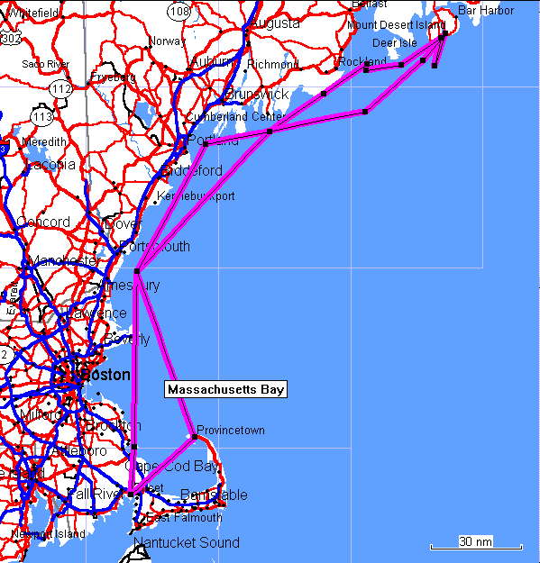
Down (wind?) to Maine, Summer 2002
Best quote: "We're three lucky
sailors" Sunday, July 14 Monday, July 15 Tuesday, July 16 Wednesday, July 17 Thursday, July 18 Friday, July 19 Saturday, July 20 Sunday, July 21 Monday, July 22 Tuesday, July 23 Wednesday, July 24 Thursday, July 25 Friday, July 26 Saturday, July 27 Long Version... Overview... We've laid out a float plan with a couple of long days at the beginning and end for the passage up and back. Short first and last days help get rolling and come back down. The two weeks were chosen based on going out and returning through the Cape Cod Canal with the current; we from Onset and Paul from Padanarum. The rest of the trip we seemed to face adverse currents, perhaps this is a bad premise. The Way Up,
North (or Down East if you prefer)... Stow, stow, stow your boat, gently start to scream....
Back on shore, as Nan prepares to make barbeque chicken for the trip, the grill runs out of propane at 6 pm! I knew all was going too smoothly. Luckily grocery stores now stock refills and soon we have a new, legal tank with a triangular knob and an overfill valve. And we'll have lunches for the passage north. Sunday, July 14 We're off our mooring at 11:15 am, late
as usual, although still in time for the current. Paul, getting
an unusually early start (for him) from having overnighted in
Mattapoisett, is well ahead of us through the canal. Out into
Cape Cod Bay at 12:30, we have a gentle SW that moves us at 5
knots towards Provincetown. We turn off course 10 degrees and
add half a knot. Not the flat-out run of the year before, but
we're off on vacation and sailing! By 2:30 the wind has dropped
and we begin what is to become standard practice - motoring.
The Pilgrim tower has been in sight for many miles, although
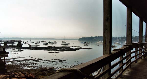
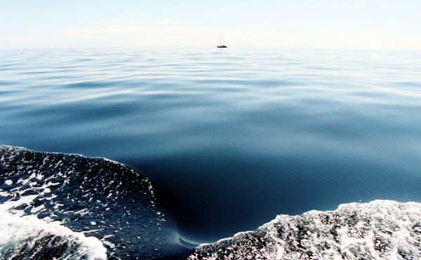
Aurora never appears. The chart shows Long Point beach and then deep water. There is a narrow band where the depth is perfect, with good holding in sand, although the depth sounder will show wide variances as you move about. Paul drops his Danforth in 22-32 feet of water, just in from the Coast Guard mooring buoy, and we're rafted by 4:30. While the steaks are grilling, we're
hailed from a dinghy headed for the next anchored boat. They
offered us the not-so-small remains of a birthday cake they'd
been enjoying on the beach! We trade a rousing chorus of Happy
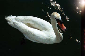
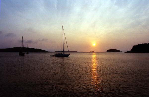
Birthday for the chocolate cake. We watch the sunken fishing
boat emerge further down the beach and the sun setting over Provincetown
(always odd to see this, looking at a place east of Boston, but
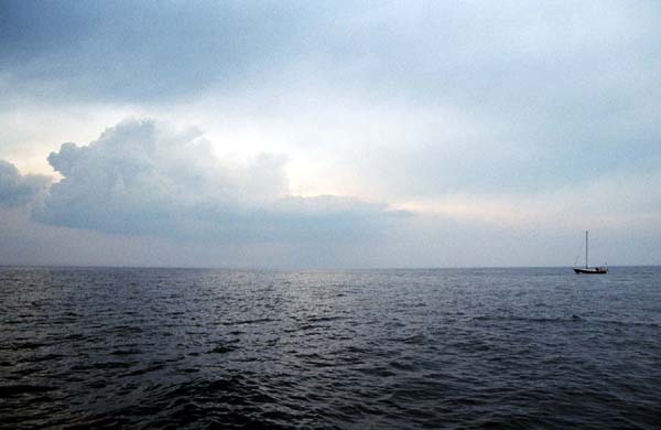
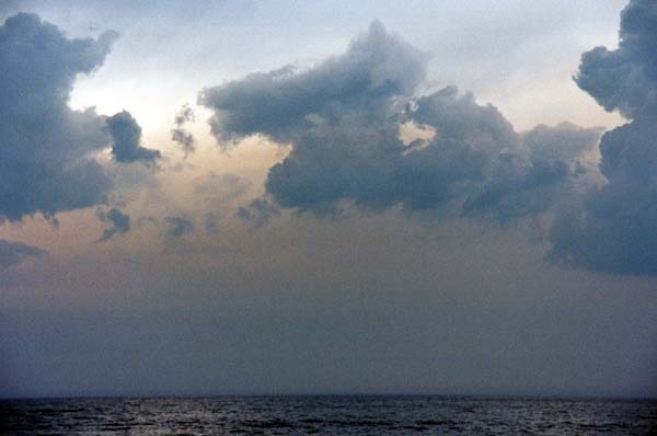
looped around on the end of the Cape). Monday, July 15 Off remarkably early at 8:15, with the Zodiac deflated and lashed to the foredeck, we bash our way around Wood End, into the SW wind and chop. We're past the #1 buoy off Race Point by 9:45 and onto a course of nearly due north for Cape Ann. Take note: although P'town looks like a good stopping place, it is actually as far in and out as any good harbor! First problem of the trip is water coming through the Vetus mushroom vent in the foredeck hatch and onto our sleeping gear. Yuk, and the dome won't spin shut so I cover the opening with duct tape. One more thing to remember to lubricate every spring! By 10:15 the breeze is up and we're doing 6+ knots across Mass Bay. Aurora ahead (he'd kept power on for longer) reports two whales and all lenses are brought out. Nothing more is seen, though. By early afternoon it is chilly in the SW wind. Then it becomes warmer and (duh?) the wind drops and sailing is now slooooow going. Cape Ann appears as a darker brush stroke in the haze along the horizon. By 4:30 we are near the Cape Ann buoy and down to 4 knots - Yanmar on and we're back to 6.2 kts. At 5:30 it's a thunderstorm drill as NOAA reports warnings all around the Boston area. How important can it be, since there are 10 minutes of drivel between announcements? But we discuss steps to take: lowering sails, taking cover in cabin, prayer.... At 6:00 with sails furled, it begins to rain and on we motor. Nan is Bugbustered in the cabin swatting flies, while I'm in the cockpit where the sprinkles of rain haven't deterred continued insect attacks.
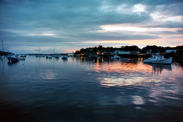
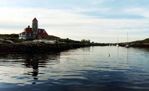
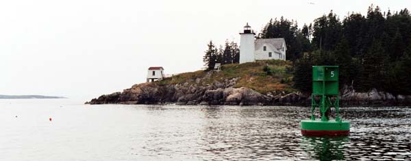
Dark clouds over the coast begin to flicker. Nan wonders about heading to safe harbor - like the Annisquam, which is exactly where the clouds hover. At 6:45 the sky lightens to the NW and it begins to rain again. But there is indeed a parting in the band of darkness and now we have distant lightning on both sides but golden skies ahead. At 7:30 the gusts hit us and we duck under the dodger. Soon, though, it's all past and by 9:00 as the sun sets over the lighthouse on White Island, we turn into the anchorage by Star Island. Where'd all the moorings go? Well, like it always seems to be, there is one unoccupied, with a lot of numbers it and, as we discover, a squeaky shackle. At 9:30 it begins to rain hard and we relax to the sound and watch the light(ning) show to the south and east over the seawall to Cedar Island. Paul declares, "we're three lucky sailors!" We boil up water and dine on a freeze-dried meal from Mountain House. Next to us is a Freedom 38, Windrush, from Boston. Tuesday, July 16 More like our usual selves, we're not off until 10:00 in the morning, but then we intend only to make it to Jewell Island. Plans for making Damariscove Island had been dropped after the long day we had Monday. I've taken apart and lubricated the Vetus vents and they're now ready for the high seas. It's one of those crystal-clear days after a front passes, and the NW wind predicted (and felt) all night is of course gone. At 11:15 Paul (of the eagle eyes) reports whales and there they are! The first time I've ever seen them and it's amazing to watch these large bodies roll in the water. A little wind picks up, but now from the NE. By 12:15 it's overcast and long sleeves come out. Now the wind is from the east; NOAA continues to predict the more useful NW. Mid-afternoon we lunch in beautiful, glassy Beaufort 0 seas. Pretty patterns of clouds and land in the water, but it's not sailing!
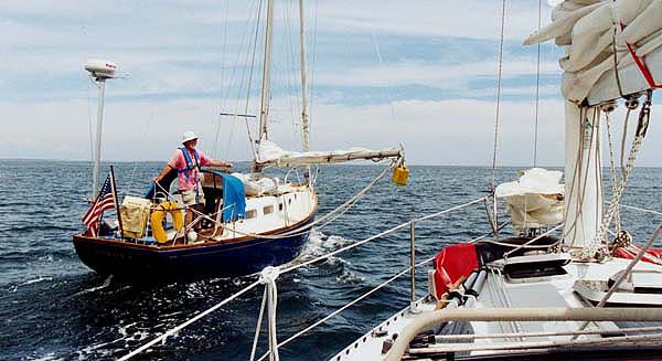
We find our way past the Green Islands, Outer and Inner, trying not to be lured inside of Hunk of Pork, and into the harbor of Jewell Island, drop our Claw anchor and raft up at 7:15. We'd try to find room to drop our Claw anchor beside a Gozzard, which is taking up two spaces. Much rude conversation ensues and we make an attempt to reset, now rafted with Aurora. Finding it difficult to come into the wind, we don't end up much better placed. We go ahead and have dinner (last of Nan's chili leftover from land) while the double-parkers mutter and screech. After a beautiful red sunset, I drive the two boats to where I'd intended in the first place and we all settle down for the night. Hmmmm, is battery #1 dead after motoring all day? Tomorrow. Wednesday, July 17
Morning systems check - oil fine, add touch of coolant, tighten up the belt on the Balmar and redo the battery connections and thumbscrews. All now appears normal on meters; that's a relief! At 9:30 we're off and, yup, no wind! We head out past Drunkard's Ledge and off to Fuller Rock and Seguin Island. A direct line from Jewell (OK, West Brown Cow) to Matinicus Island goes through each of these, (and more) and we agree to pass behind Fuller Rock and outside of Seguin Island. As we motor along there's one more thing to check and yow, we're down to 1/4 tank of diesel fuel! That long yesterday against the current was tougher that I would have thought. I add our spare gallon and things look better. Still worried and Paul says that he has a two-gallon jerry can. Soon it is perched on the end of his boom and with much muttering as his first preventer breaks, the can is swung out to starboard. We swoop by (hell, we come a lot closer when rafting!) and I pluck the can off and away we go. Feel a lot better with two more gallons in the tank!
Last year, taking the "onshore" route, we passed a number of other sailboats heading up or back down (or is the other way around?). This year we see few other sailboats, although a fleet of trawlers motors past us at Fuller Rock. We see them later, lined up in Northeast Harbor. At 1:30 it's sails up and we're motor-sailing at 6.2 kts. At two the Yanmar is off and we're only doing 5 kts, but it's quiet! Only the sound of the water and the stable feel of a nice heel. It's a chilly south wind and by mid-afternoon we have to put the dodger back up! We pass south of Damariscove Island and can see into the harbor - another time! And then north of Monhegan Island, looking at the tiny harbor and skipping past Duck Rocks. And we are rocking along at 6.3 knots! Our Freedom and Paul's Luders have the same PHRF rating, and it's always been interesting to see which boat is faster. (No, we're not racing, just cruising, sir.) In light air, his classic plastic has often pulled ahead, but today we ease past him well before Monhegan and keep the advantage while we're under sail. A little after 5 o'clock we consider whether we'll be getting where we're going by nightfall. Especially since Paul's wife Sally is (or should be) by now waiting on Matinicus after being taking the ferry from Rockland. So the iron genny comes back on and we motor on into serious overcast (but no storm). The charts come out for real when it turns out that I didn't load the quadrant with Matinicus into the Garmin. Looks like one blob of an island and not the several that make up the area. We peer through the oncoming darkness, picking out the two red marks and heading between Criehaven and Matinicus and around Tenpound Island. Criehaven looks like an interesting harbor to visit some (other) time. Turning past The Barrel ledge we enter Matinicus Harbor. No sticks - we're out of yachting territory! And yes, there's a lone figure on the lobster pier; could that be Sally? Paul heads off to investigate and we look for moorings. There are supposed to be rental moorings, but we don't see them. Finally we grab a fishing boat's float with a dainty one-and-a-half loop that smothers our bow cleat. Paul rafts up, throws his dinghy in the water, and heads off to pick up Sally. I call the phone numbers in the Embassy Guide but one number doesn't answer and the other is a guy no longer involved in the mooring business. But he says the moorings are out there; he saw them that afternoon. We stay on the one we have and pass a quiet evening, finishing off the barbeque chicken. Penobscot
Bay... Matinicus has one of those Maine harbors that isn't just a large cove, but rather a protected space formed by a couple of islands. In this case, it's Wheaton Island along with Matinicus, and there is a channel between them to the south that appears navigable (though I'd not try it). Sally tells us all about her afternoon on the island and how Wendy the postmistress is the source of all local knowledge. She monitors channel 19 and we call her in the morning to ask about fuel. Wendy tells us we can buy some if it's an emergency. It will turn out to be, but doesn't seem like one so we don't pursue it. Several fishing boats come and go, none making much noise or wake, and we feel tolerated in this working harbor. We finally do see the rental moorings, all in the entrance channel - not a nice place to be!
A beautiful warm morning and we're off at 10:30. The Freedom's fractional jib fails to go up, becoming caught on a spiral of wire of thea broken strand on the forestay. (A spare awaits a quiet moment to go aloft.) After a few moments of thought, I run the top few hanks up the spinnaker halyard, leaving the rest on the stay. Works fine! Just before noon, porpoises spotted astern. From then on, every large wave looks like one but all gone. The day becomes hazy and cooler. You can see fog around the edges of Vinalhaven and Camden Hills in the distance. Yes, we're really in Maine! A seal pops its head up to port and a bird flies around squawking. But then it's power-up time as no wind for a change. At 1:30 as we pass Eastern Ear at the SE corner of Isle Au Haut, I power down with the realization that there's not enough fuel for another day's motoring. Shoulda filled at least the jerry cans at Matinicus! Discuss just how much fuel there can be with less than a quarter tank. Certainly not the 3 gallons which a linear scale would promise. We sail slowly on the outside path while Paul motor sails the scenic route closer past Isle Au Haut, inside the Spoon Islands. Paul radios that after all it's as far to Swan's as previous day's passages and that we're welcome to sail, arriving whenever, but why not motor and if all fails, he can tow us in. So back on around 2:30 and we motor sail at 2500 rpm. And we're back on the Garmin chart. And now we have ANTS! The ledges guarding Marshall Island form the south are amazing. Can't imagine finding one's way around with ded reckoning. And that doesn't even take into account the lobster pots!
By 4:00 we're outside Burnt Coat Harbor with it's well-hidden entrance and motor in. We call the Fisherman's Coop (by cell phone, no answer on the radio) and ask if they sell fuel. They will if no more lobster boats are coming in and so come on in once the one on the pier leaves. With great relief we take on 11.8 gallons, including the spare can. (Based on a more recent experience, this means we basically running on empty.) We also fill up our water tanks at their main pier and they will take trash for $2 a bag (when there's room in the dumpster). Given where we are, I also buy four hard-shell lobster. They (the coop) were very friendly and a great resource. 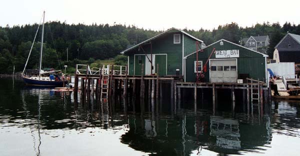
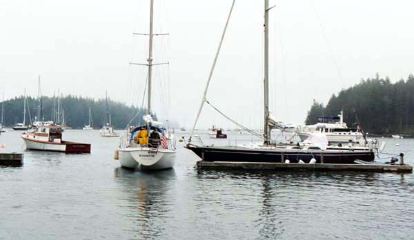
We all head across to the "mainland" of the island to attempt a trek to the one store. Picking up a mooring, Paul, Sally and I dinghy in to the town pier and head out as directed by a family fishing. They later pick us up as we trudge along and get us to the store at closing time, 6pm. A good general store, it has orange juice cheaper than Boston, and big bags of ice and blocks. (As learned later, may also be closing - the only store on the island!) Loaded down with ice and whatnot, we begin the long walk back down to the harbor. Sally hungs out her thumb, and in no time Christine, a student at Orono amd sometime lobster boat stern man, has picked us up in her Jeep and deposited us at the pier. The mooring we'd picked up looked okay, but we appear to be on the lee shore, so decide to return to the west side. Paul drives both boats back, rafted, and at the behest of the wives, we pick up a rental mooring. In short order a charming fellow appears, chats us up and then hits for $20 per boat. Given that there are a lot of empty moorings and a large anchoring area, this is remarkable (and the most we will pay the entire trip)! Afterwards we look at each other and wonder why no one spoke up. He'd charmed the women and, hey it was their money, so who were we men to intrude on their dealings? The lobster makes all thoughts of pots as hazards to navigation disappear. They are truly so sweet that the butter is an unnecessary excess. Friday, July 19 During the night the wind shifts to the NE, leaving us on the lee short of the harbor, after all. It's overcast and a little rainy, but beautiful and peaceful and we dinghy in, tie up at the Coop and go ashore for a walk. Pretty rural, with some signs of homes being fixed up (year-round or summer residents?) We investigate a property for sale, a rocky bluff overlooking the harbor. Be quite a job tunnelling in the utilities! At mid-morning we leave for Mount Desert Island, taking the interesting east entrance to the harbor. One of those places that looks kind of suspicious on the chart, but turns out to be well marked with two green cans, and in no time we have the hazy "mounts" in sight. We once again have a schedule to meet: Paul's and Sally's daughter and boyfriend are arriving tonight to spend the weekend on Aurora. Still the light NE wind, but we motor sail our way between the Sister Islands and Frenchboro, past Black Island and the Little and Great Gotts and across to Mount Desert Island, entering the wonderfully lobster pot-free channel at 2:30. We pass through the Hinckley moorings, searching for Todd Dunn's Allied, but no sign of it, visually or by VHF. Heading up to the NW end of the harbor, we pick up a couple of moorings (yuk, perhaps should buy some gloves!) and head into town to provision. The town dock has a room for dinghies (with a stern prohibition about unregistered ones). A short walk beings us into the center of town and we visit the drugstore, finally remembering Raid, the hardware store and Sawyers market. All are well stocked with cruisers' needs and Sawyers has a real butcher in residence with fine cuts of beef. To add some suspense to the day, Sally gets a cell phone call from her daughter, explaining that the car left in Tenants Harbor is to be towed for a parade. Should she try to rescue it. Can she get there in time, anyway, on the way from Boston to Northeast Harbor? Heading back out, we make the quick trip over to Northeast Harbor. Having now contacted Todd by radio, we pass by Seaquester rafted to one of the floats. We exchange greetings and wander around as Aurora selects a mooring type. There are a series of floats which one can tie up to and have a little piece of "land" by the boat. This would offer a nice arrangement for a group of cruisers, but also provide unknown close neighbors. It also means that you don't swing with the wind, leaving you open to rain in the cockpit. By 6:30 we're rafted on a mooring. The woman picking up the money and, hearing of our trip so far, asks if the Swan's Island store has closed. (There had been a sign that all local accounts were to be closed by July 8th.) She and her husband, both schoolteachers, had considered buying and running the store. Agreed that it sounded "exciting and different," but perhaps they'd better keep their day jobs. Northeast is a wonderful harbor. It does have the reputation (okay, and the history to prove it) of being for the veddy, veddy rich. Sally in fact summered there, working at the great resort at the head of the harbor, where she had to enter only through the servants' entrance. But the boats moored range from mid-20 cruisers up to the Swans and Hinckleys, with boats in the middle like an Allied Seawind 30. And the cottages along the shore, although large, are mostly interesting multi-level affairs and not McMansions. Perhaps old money, not new, makes a difference. And it is a very well protected harbor, especially compared to Southwest, which is wide open to the, well, northeast.
Then the fog rolls in and it begins to rain. Todd has headed back to SW to get through the fog in daylight, not that it is an unusual obstacle for him. The rain keeps up and we dash between the boats and cook the steaks in brief bursts of attention. During the downpour the cell phone rings, and the kids have arrived to be ferried out from shore. And Sally's car is safe in a Tenant's Harbor schoolyard. Saturday, July 20 A busy day is planned for this clear day following the rain. A trip into town first satisfies that major cruising need - showers. The Yachting House provides showers for a dollar, four quarters to be precise, inserted into a timer. Can't give many points for the temperature control, but all your needs can be taken care of, and the staff can offer information and guides to the area. And the harbormaster's office makes change (and since it's closer to the dinghy dock, stop there first)! The town, a short walk up from the harbor, offers shopping in the vein of Nantucket - expensive. The Ace hardware store carries a goodly amount of marine stuff. On the way down to the boats, we grab sandwiches and ice cream. Then we're off to visit Soames Sound, America's only fiord, which we motor up as far as Valley Cove. This is the only real anchorage, but one with a very narrow band of suitable depth. That seen, we spin around, up sail and head south to Frenchboro, aka Lunt's harbor on Long Island (one of many so named, to be certain). Back through the intersection of the MDI harbors, dodging a regatta, out the way we'd come in Friday, actually sailing for a day! Frenchboro is the Hadley Harbor of the region, the quiet harbor to spend the night in - and here it is Saturday. One sailboat, which had shadowed us, enters ahead, but then heads right out past Harbor Island. Can they tell that the harbor is full? Paul the optimist forges ahead and when we catch up, he is picking up an empty mooring! We've barely rafted up when a lobster boat, Renegade, shows up claiming the spot. But instead of just kicking us off, he points out that there is a mooring hidden behind the next boat, which we can take. Friendly, yes! And he even asks if any other boats are coming in, because another nearby mooring will shortly be free. We try to get the attention of the previously mentioned sailboat, which has returned, but a powerboat zooms in and takes the ball as soon as it is unoccupied. Sort of like watching parking spaces in Harvard Square (back when you could park there - showing my age)!
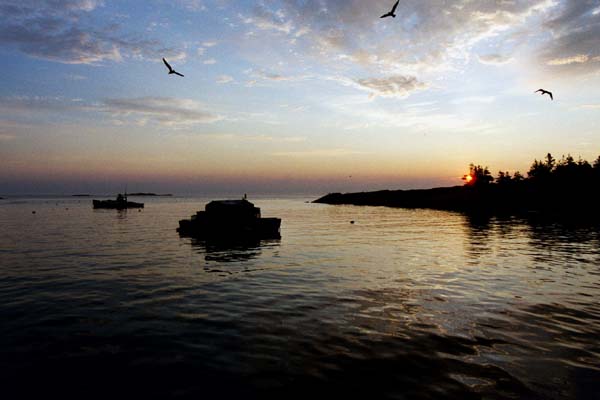
Night falls with shadows cast across the harbor. The ferry pier takes on a mystical appearance; lighted just in case a ship were to come? Having missed the chance to get food from the Lunt's restaurant, we boil up a packet of Mountain House lasagna.
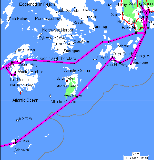
Sunday, July 21 The day dawns sunny and still. Renegade comes onto the lobster float blasting southern rock. A dinghy powers by with only a pair of boots showing (that's a missed picture). This is to be a day of interesting passages. We will leave Frenchman Bay, pass through Blue Hill and Jerico Bays and finish up in Merchant's Row. In between will be Bass Harbor Bar and Casco Passage. But first it's back to MDI for assorted errands.
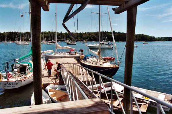
Off at 9:45, we motor back north, Aurora heading to NE Harbor to drop off the kids, while we return to SW to meet up with Todd and Linda Dunn. We find them where expected and quickly raft up. A study in contrasts compared to Jabberwocky, Seaquestor is a larger relative of Aurora. Todd, the creator of the Denizens [of the CW Bulletin Board] Page, is a happily retired college professor. He's lovingly restored his 1972 Princess 26 and we take a tour, after which we reciprocate. Nan and Linda trade stories of late-in-life lawyers while Todd takes me ashore for trash disposal and genuine Hinckley ice. It's amazing to believe that they take the time to mold the "H" into every block! Paul and Sally arrive and the tours continue, this time comparing two close cousins.
As we belatedly leave at 2:30, Todd says, Casco Passage isn't as bad as it looks on the chart! Hope not; it looks full of shallows and marks. By 4:00 we've motorsailed to Bass Harbor Bar, having first slowly sailed out of MDI. The zigzag through the shallow passage is interesting, and then we can almost fetch Casco Passage. Blue Hill Bay is pretty, with Swans Island spread along the southern edge, and an open vista to the north, spotted with islands. The wind is light, eventually making clear that we can't point high enough to get where we want to go. Aurora pulls ahead and we tack and then motorsail. There are at least three ways through Casco Passage, Paul disappears from sight as he takes the lower route by Orono Island. We continue straight on the winding path of a well-marked channel through a deceptively wide-open but in fact shallow area. Nice to have the marks plus no fog! And given the adverse current (not Woods Hole, but significant) glad we have the Yanmar on. By taking this northerly route, we'll also have a better wind angle for the rest of the day's sailing.
Once into Jerico Bay and past the Red TR on Spindle of Egg Rock, we face a dizzying array of islands and marks. You look at the chart and align with the GPS, but things don't seem to be quite where you think they are. Aurora and we independently pass a red/black mark labeled DW, which neither of us can find on any chart, paper or electronic. Is it Whaleback Ledge? Are we lost? There are also a lot of lobster pots, as we'd been warned. It finally becomes clear where Merchants Row is (where I thought it was, despite the marks) and thus our destination. Aurora comes into sight and we sail up even with her and tack over to her course. They had taken longer than expected to get through Casco Passage and then picked up a lobster pot even with the motor off. We had planned on anchoring at Wreck Island, but sailing behind No Man's Island (quite some names here) Paul can no longer make way. At first he attempts to tow Aurora with his dinghy, but drifts towards Little McGlathery. I go below and fetch a spare anchor rode and soon we have them under tow. It's nice to be able to get out of trouble all by yourself, but accepting help can be a lot easier and safer.
The open harbor of McGlathery proper is now before us and as the sun is setting, we decide to stop there for the night. Can we drop anchor while towing another boat? Interesting idea, but since Paul still has his anchor gear (he was first going to take off his anchor and pass his rode for the tow) we agree on our easing him into the anchorage to drop the hook. Which we do and he does and soon enough we are rafted as usual. The steak from Brown's was almost as good as those from Sawyers. And yet another fine sunset.
Monday, July 22 The morning is brisk and McGlathery turns out to have been a good place to stop in that it's well sheltered from the SW which seems to blowing pretty good. Although the harbor is well shaped, some of the protection comes from neighboring islands. Its totally open to the NE, although Spruce Island would limit the fetch, but I'd rather not try it!
Sven says it's blowing 20-25, so we set Jabberwocky with one reef and at 10:30 head out between McGlathery and Round Islands (watch the narrow, shallow spot!) and into Merchants Row. Where it's indeed blowing like stink and we're glad we have the reef in. We motor past the red triangle, turn to the west and off we go! Paul rolls out only a bit of genoa, and we storm by them, past Ewe and Sparrow Islands, The Brown Cow and out into Penobscot Ba y. This is way fun and all too short as we blow into the eastern mouth of Fox Island Thorofare.
Once inside we are against the wind, heading down to the right-hand turn at North Haven. We put a second reef in, but after rounding the turn at 1 pm, we're too sheltered to do more than motor sail. And after we round Brown's Head and head down past Crockett Point, we're dead into the wind and continue to motor. It's a route inside the ledges guarding Vinalhaven and we keep a sharp eye on the chart and the marks. It's easy to spot Long Cove on the chart, but less evident how to get there. Behind Dogfish and north of Ledbetter Islands there's a narrow channel leading to an open bay (with deceptive depth or lack thereof!) Past Turnip and around Hall Islands and we're headed up the cove by 1 on the afternoon. Although the Cove is described as sheltered from the SW, the wind comes right up between the islands. We drop anchor as far to the west as possible to be shielded and Aurora rafts up. Looking out of the cove, we can see Hurricane Island, shrouded in fog. IT is interesting to compare the paper ChartKit, which shows that we should be seeing Winter Islands, whereas the Garmin chart shows us as we are. Tuesday, July 23
We motor back around Crockett Point, back to Fox Island Thorofare and North Haven. Just like the big boys with roller-furler genoas we hoist our jib and indeed it helps pull us along on the SW. And it does go up easily on the new stay! Sally calls on the cell phone that works here and is told that Brown & Son has no moorings, but we're welcome to "look around." Since thunderstorms are predicted for the evening, most boats seem to have decided to stay put.
Aurora heads in to the fuel dock as we maneuver through the mooring field. At the very end there is an unoccupied float, #00, which we grab. After a VHF conversation, Sally on shore asks about the mooring. It is determined that it belongs to a lobsterman around in Pulpit Harbor for the night and we can stay on it. Oh yes, $10. (Will the fisherman see that money?) North Haven must be an acquired taste. Last year we spent an uncomfortable day there as we dealt with a fuel dock encrusted with unmoving boats (hauled the water hose across at least two rafted boats to ours) and a restaurant out of most selections. Denizen DonB felt the same way on his pass by this year and he continued on to Tenants. We had a fine time this trip, perhaps having an understanding of just where cruisers fit into the scheme of things. We didn't yet need fuel, and they were kind enough to tell Paul that he might not want the water, anyway.
After rafting up, we all go ashore for late lunch, shopping, provisioning and cleansings. The snack bar stops food service at 3:00; we arrive at 2:55. After some negotiation we are able to get four lobster rolls and then ice cream for desert (that window stays open). Mmmmmm good! Oh yes, the weather prediction: suddenly the sky darkens. Perhaps I should go back out and close Jabberwocky's assorted hatches and ports! I run back to Paul's Achillies, which is fortuitous, as he'd tied up to the inshore end of the dingy dock, and the inflatable is now "low on water." On my return, I don't see any of the others, so I head for the showers - priorities. The clerk at the market tells me it will be $6. For one shower I ask? No, for two - single persons need not apply! I pay the $6 and say that Nan will arrive soon. A great shower with unlimited water with great pressure and I'm clean. I keep a lookout for Nan or the others but I'm dry before I hear familiar voices outside the market. They have been shopping and also running laundry down in the basement. This is the only problematic part of the shore visit: the clothes all smell of the detergent and nothing gets dry after many many quarters have been fed. We lug the clothes back to the boats, stopping for blocks of ice.
Paul and Sally head back to shore for an evening with friends. I inflate our Zodiac on deck in the rain and we head in for dinner at the Coal Wharf Restaurant (reservations suggested). The restaurant is in a fixed up old building, amidst the rotting remains of an old wharf (oddly enough, given the name). We get a table with a view of our boats to the SE and the dark-clouded sky to the west. Despite the obvious lobster and several fancy-sounding items, we both order lasagna. Baked in individual dishes, it is an excellent and perfect for a cool evening. The horizon clears as we finish, and we return to Jabberwocky in time for a golden sunset.
The Way
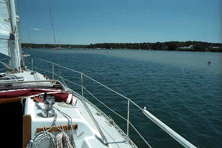
Down, South (never heard of Up West)... The front is clearly past in the morning and we are off at 9:30 with a pleasant N breeze. With just enough wind not to motor, we rock back and forth in the sun as we cross the western side of Penobscot Bay. When we pass Fisherman Island and enter Muscle Ridge Channel, it is motor time again as we play dodgem with the lobster pots. This motoring business is always an issue on cruising in a sailboat. We could have made it to Tenants Harbor by the end of the day under sail, even against the current. But then that's as far as we'd have gotten, leaving us in arrears for the remainder of the trip. Do this a few days and there's another week! Perhaps the all-sail is appropriate for a pure cruising life-style, but for a vacation far from home port (at least in sailing terms) the rule of never go below 4 kts lets you keep a schedule.
We tie up at Cods End, Tenants Harbor at 1:30 and take on all sorts of things like fuel, water, ice, crab rolls and lobster (and off-load trash). A very welcoming place to stop with a three sided fuel dock and a cruiser-friendly attitude. The young staff is agile at switching the assorted hoses around, juggling the purchased items (even water costs) and making change. As we'd found Sally on a pier on Matinicus, so we leave her here.
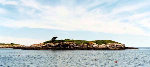
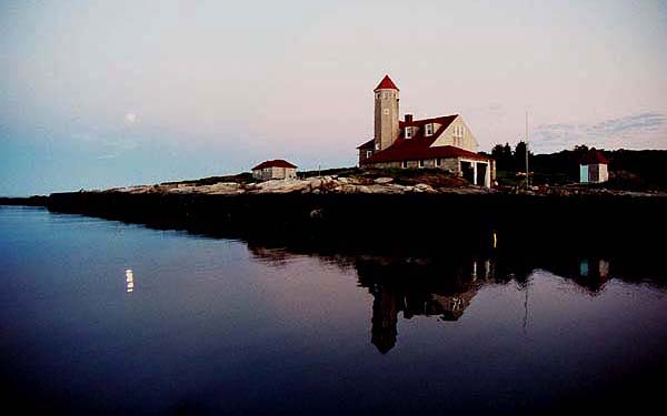
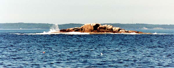
Motoring out past the Wyeth's island, the seas are glassy as far as can be seen. And we must be out of Maine, or nearly so, as it is quite hot! We take the inside route, then, slightly more direct than the outside, past Port Clyde, through Davis Strait and past Eastern Egg Rock. And there's a SW wind! Of course that's the way we're headed, so motorsailing is the result. The long-awaited goal is in sight, though, as the two towers of Damariscove appear and disappear as we pass outside of Outer Island and around Outer Heron Island. We can then sail along Damariscove, a low flat, green mound with the eastern tower slowly changing its position as we pass it by. We head for the red marking the entrance and turn in. What a magical place! Damariscove is really like three islands, two side-by-side and one blocking the western end. The harbor is the cleft between the two at the open end. The island is now are mostly uninhabited and covered with grass and wild flowers. The southern island has an old life-saving station complete with tower; the northern island has a smaller tower, probably once a lighthouse or spotting platform. It's like sailing into a fairyland dream world.
It is hard to drop our sails, now that we're on a beam reach into the harbor, but Paul has motored ahead and already has a mooring. Not a lot of room between the two fingers of the island, although as with most anchorages, there's more room than first appears. The four moorings are now taken (ours the outermost, natch) and a couple of other boats are anchored, one wisely fore and aft to keep aligned with the space. It's 7 pm and we're on a mooring with an oil bottle for a float, there're only a few other boats nearby, just the old life-saving station next to us and.... We hop into the dinghy and paddle our way up the harbor. As we pass the other boats, all exchange greetings - a friendly place indeed!
Landing at a float we tie up and head ashore. The islands but for the life saving station now belong to the Nature Conservancy, who staff the place and maintain a one-room museum. The trails are clearly marked and there are maps showing the area. We check out the museum, where we learn that the island was once one of the most populated and wealthy parts of the seaboard. Ships would bring in whales....
After watching a magnificent sunset over Casco Bay, we head back to the boats to try out the Cods End lobsters. Not as good as the Swan's Island Coop. After dinner we haul the Zodiac on the deck to dry so we can roll it up in the morning.
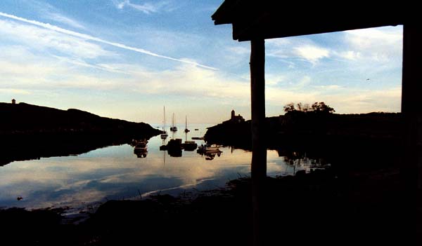
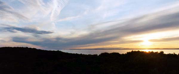
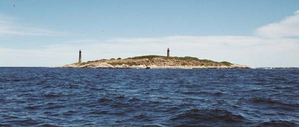
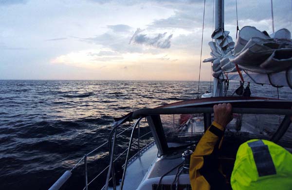
Although we are at the open end of the harbor and can hear the surf on the rocky ends of the island (especially as the tide rises), the motion remains reasonable. Just the roar of the surf, the gentle swells from the ocean and the sound of the birds. We sleep well, rising at dawn (well, I do) to see the full moon set behind the life-saving station. Thursday, July 25 Another windless day for motoring, NE was predicted which would have been excellent. Off at 9:15, the bimini goes up and the dodger comes down - must be getting into the tropics by now. A whale off the port bow! A seal pops up off the starboard quarter, but is small stuff now. And hey, there are no lobster pots! On the last of the cell phone batteries, Nan learns that she's got a new job with legal services in Cambridge! Not a bad morning even if we're motoring. After noon, sails come up and we continue to motorsail. More whales appear to port - this time we can see the spume filling the air and the bodies rolling in the sea. By mid-afternoon, the seas are glassy and we give up on the sails (they're blocking the sun, anyway). We never did shut down the 2GM. We are taking an outside route to Isles of Shoals, not the usual one from Jewell Island, and we get a good look at Boone Island, usually a lone tower to the east. Close-up, it is a forbidding place. We also find a new approach to the Isles, passing east of Duck and Appledore and around between it and Smuttynose (which the Garmin software wants to call Malaga?). A little shallow at one spot (as marked) and we loop around into Gosport harbor as (this is getting to be a habit) the sun sets. As we enter the mooring area, we see a couple free ones back by the brerakwater. As we head towards one, we suddenly hear the engine of the powerboat at a nearby mooring. Was that already on, or is he exercising his territorial imperative and setting up a do not enter zone? So we raft on a mooring nearer the entrance at 8:00 pm. At 8:15 the orange Nova Scotia-ported fishing boat shows up and Paul says, this is theirs! We quickly drop off and all is friendly as we move to the one with the creaky shackle we had last time. The fishing boat turns out to be from the Isles, recently acquired and brought down from N.S. The moon rises, full, huge and orange over the Cedar Island breakwater. In the harbor is a Freedom 36, Segue, from Bristol, RI. Friday, July 26 We awake to wind, actually rolling in it! We're off at 9:30 and by 10:00 are sailing past the White Island lighthouse. At 10:05, ha, well maybe we should motorsail for a while after all. It's a perfect wind if we weren't planning on rounding Cape Ann. A SE wind, which never happens except in NOAA forecasts, it could take us to the Annisquam River, our usual path south. Should we go with the flow or follow our plan? Last year at this point we were trying for the inside route, nursing an overheating diesel, and of course facing the usual SW. A flock of shearwaters rushes by, striding across Bigelow Bight. Another missed photo op! Keeping with the goal of taking the shortest route at all times, especially if it is also tricky, we agree to pass inside of Thacher Island. This means avoiding a shallow patch called Flat Ground and the "sunken breakwater" guarding Rockport harbor. We pick out the relevant marks from the chart, and then puzzle them out as they appear ahead. Paul actually ends up over the Flat Ground and suggests that we not - it's quite rough there.
By 1 pm we're past Thacher and Milk Islands, heading SW, and SAILING! After all the motoring in Maine, here we are in Mass Bay, speeding along on a SE wind. This is truly heading Down West! At 2:30 we're on a delightful close reach, seas rolling past in the upper 5's and 6 kts. It's a bit chilly - it's one of those tacks where the main puts you in the shade. (When a heat wave hits the following two weeks, it's a fine memory.)
Boston is just some bumps on the gleaming horizon. By 4:30 though, it's overcast, decidedly cool, and the dodger comes up. It's amazing to speed across the entire Mass Bay like this, and eventually the South Shore comes into view, even Minot's Light hardly visible. At 7:30 the sun is back out and Plymouth is in sight. We're really cooking alone now in the upper 6s. I wonder about the meaning of a two-nuke day, Seabrook and Pilgrim. At 9:15 we turn at Bug Light and rendezvous with Aurora off Clark's Island. Paul had kept his Yanmar on much longer then we, and had long ago disappeared into the haze of Mass Bay. After a touchy moment (no pun intended) when we get too close to the island, we anchor just of the channel to Duxbury. Not a bad spot, protected from most all but a direct south or north wind, and not as far in as Plymouth harbor, much less Duxbury. A final on-board meal of Mountain House Mexican Chicken! Saturday, July 27 The final day brings an overcast sky and a light SW wind. We make preparations slowly; this two-boat team will shortly be over. We finally weigh anchor and Paul heads into Duxbury to pick up Sally and friends while we turn south. Exiting Plymouth Bay, it is clear that the greens guarding the shallow bay are not as marked on any charts. We also face a two-knot foul current and are not really out in Cape Cod Bay until noon. It must be Saturday, powerboats all over the place! But even a few lobster pots in the channel can't make us think we're still in Maine. Motorsailing past Manomet, I look up and see that the Windex is a kilter. After two weeks, the two boats finally kissed in the night? Perhaps I should by an ATN Ascender? At 1:30 we've got a SW and can sail towards the east canal entrance. Arriving we see a sailboat or two exiting; odd since I thought it'd be the height of the western current. Don't know how they'd done it, but I'd read the tables correctly back in May and we are boosted through at a fine clip. We even face some serious chop in the mid stretch of the canal as we counter the SW wind. We emerge by the Maritime Academy and there's Onset! It's always with a feeling of satisfaction and familiarity to return to our homeport. I notice that the chart shows a shortcut channel across to Onset Island, but I decide not to try it today. Around the big green day mark, up the zigzag channel, drop sails by the Onset Bay Marina, motor into the main harbor, pull into a slip at the town pier, and we're home! Nan gets the car, we dump as much as we can into it (took more than one trip to full Jabberwocky!), and I take her back to the mooring. When I return to the cockpit after cleaning up, who should be coming into the harbor but Aurora! For dinner we just get pizza from Marc Anthony's in the village. Ahhhhhhhhhhhhh! What Worked and What Didn't... New this year were real sheets and blankets! A definate improvement over sleeping bags. We also have a new CD/MP3 player after the one the original owner had installed finally died last year. This provided some enjoyable evenings of suitable Cape Breton music (Rankins, Natalie MacMaster). Less exciting but worthwhile was the new holding tank which made nights in the forecabin more pleasant. A manual pumpout for the tank made it possible to empty it offshore; pumpouts being quite rare in Maine, compared to Buzzards Bay. The new chart light for the cockpit was never needed, I'm happy to say. Best new clothing of the year was down vests from the Lands End overstock catalog. These were just the thing for cool afternoons when a sweater would have been too much. As always with Maine in the summer, it's cool at night and you need long, warm stuff, but like anywhere it's warm in the sun when it's shorts and T-shirt time. Some days I'd put on and take off a fleece shirt several times in an afternoon! As we found last year, the Mountain House camp meals were fine for when fresh food ran out. Again our combination of navigational tooks worked well: a large-scale NOAA chart for the big picture, the ChartKit for closer-in work, the Garmin GPSmap 76 with Waterways&Lights CD detail for planning and positions, the Taft Guide for good local knowledge and the Embassy Guide for phone numbers and harbor mini-charts. |
|
Home Sailing NE IlesShots Freedom 28 Onset MA BW Photos |
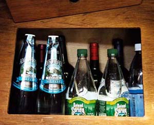 No
matter how organized your boat appears to be, once two weeks
of provisions are added, chaos reigns. Did find that the small
space under the starboard settee, where I'd always stuffed bottles,
when approached with some thought neatly holds a dozen bottles
of wine and seltzer. The new holding tank and under-berth painting
has removed the odor, so finally we can stow clothing and towels
in the forecabin. The quarter berth, however, remains filled
with projects: a carton of assorted cleaning materials, parts
for new bimini supports, a replacement forestay, spare reefing
line for the one that looks weary, the sailcovers....
No
matter how organized your boat appears to be, once two weeks
of provisions are added, chaos reigns. Did find that the small
space under the starboard settee, where I'd always stuffed bottles,
when approached with some thought neatly holds a dozen bottles
of wine and seltzer. The new holding tank and under-berth painting
has removed the odor, so finally we can stow clothing and towels
in the forecabin. The quarter berth, however, remains filled
with projects: a carton of assorted cleaning materials, parts
for new bimini supports, a replacement forestay, spare reefing
line for the one that looks weary, the sailcovers....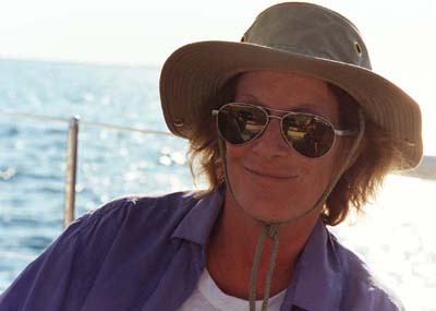 Turns out that he'd
motored even sooner to drop off his crew to make the ferry back
to Boston. He is heading back out from the town wharf as we round
Wood End and we meet up at the anchorage off the beach.
Turns out that he'd
motored even sooner to drop off his crew to make the ferry back
to Boston. He is heading back out from the town wharf as we round
Wood End and we meet up at the anchorage off the beach.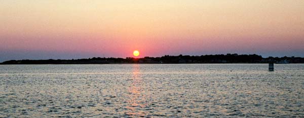


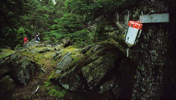

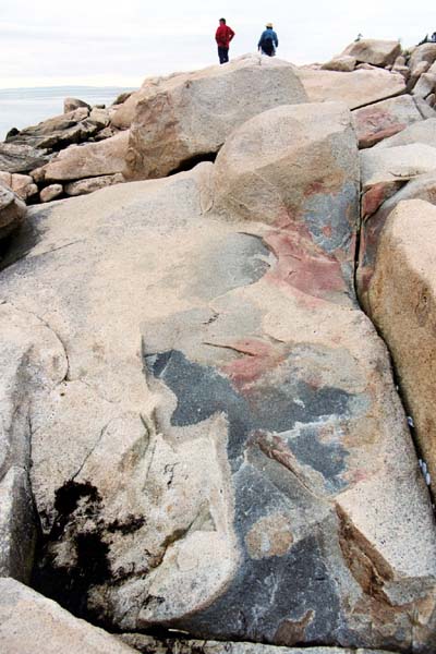 Wandering south, we come across
a faint marker and slough through the forest until we come out
on a wide, rocky beach, with an open view south across the Gulf
of Maine, Swan's Island just to the right. No condos, no McMansions,
just an empty rocky beach. Well, around to the east, after hiking
through a mossy green jungle, we do come across a fallen down
beachcombers shack. There is a lightening on the horizon, and
as we explore, the sky slowly clears. When we return to the harbor,
we can actually see Mt. Desert Island without the scrim of haze.
And by the time we get back to the boats, the sun is out!
Wandering south, we come across
a faint marker and slough through the forest until we come out
on a wide, rocky beach, with an open view south across the Gulf
of Maine, Swan's Island just to the right. No condos, no McMansions,
just an empty rocky beach. Well, around to the east, after hiking
through a mossy green jungle, we do come across a fallen down
beachcombers shack. There is a lightening on the horizon, and
as we explore, the sky slowly clears. When we return to the harbor,
we can actually see Mt. Desert Island without the scrim of haze.
And by the time we get back to the boats, the sun is out!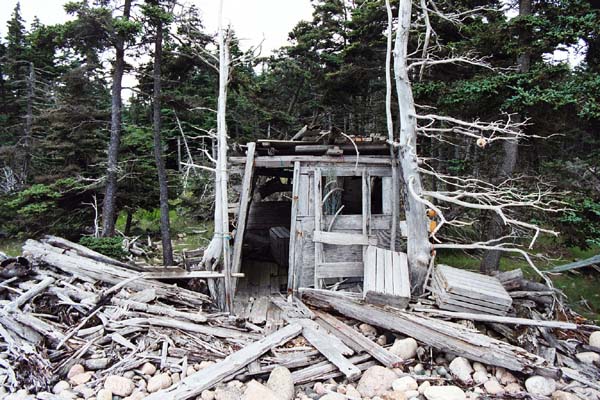


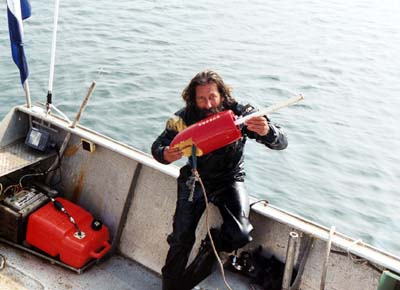 First
project is to get Aurora free of the lobster pot parts. In cell
phone communication with a yard in Stonington and various possible
rescue services, Sally learns of one possible diver, but who
might charge $300-500. Around 9 am a small boat motors up, flying
an unfamiliar flag and containing one dry-suited person. Before
letting him in the water, Paul confirms the price - $100! Is
possible that a competitor wanted to make him seem unreasonable?
He dons his mask, grabs a mouthpiece, rolls over the gunwales,
and is back up brandishing a float in less time than I can grab
the camera. He says he does six-to-ten of these a day, including
freeing lobster boats! There are a lot of pots in the area and
the Bavaria 39 anchored out tells us they know of 4 cruisers
entangled this week. Don't lose this number: Johnny's Dive Service
- 207 367-5061 - channels 16 and 69.
First
project is to get Aurora free of the lobster pot parts. In cell
phone communication with a yard in Stonington and various possible
rescue services, Sally learns of one possible diver, but who
might charge $300-500. Around 9 am a small boat motors up, flying
an unfamiliar flag and containing one dry-suited person. Before
letting him in the water, Paul confirms the price - $100! Is
possible that a competitor wanted to make him seem unreasonable?
He dons his mask, grabs a mouthpiece, rolls over the gunwales,
and is back up brandishing a float in less time than I can grab
the camera. He says he does six-to-ten of these a day, including
freeing lobster boats! There are a lot of pots in the area and
the Bavaria 39 anchored out tells us they know of 4 cruisers
entangled this week. Don't lose this number: Johnny's Dive Service
- 207 367-5061 - channels 16 and 69.
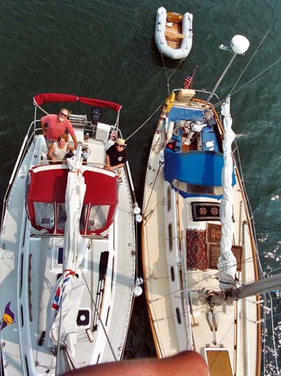 Morning
finally brings the adventure of replacing Jabberwocky's forestay.
I've been up the mast once before, also when anchored with and
winched by Paul. Then I didn't look around much but held tight
to the big round mast. The moments I did by chance look past
the mast, view was breathtaking. So this time I bring the camera
with me, along with the tools and new stay. Removing the old
marine eye and inserting the new goes smoothly and I then finally
get to take one of those shots of the deck from above. When I
return to sea level, my legs look awlgripped but all is intact.It's
interesting to see the difference between the two boats. Aurora
is 33 to our 28 feet, LOA, but 9 to out 10-1/2 beam. The interior
room is not that much different and the waterline length is similar
(As are the PHRF ratings).
Morning
finally brings the adventure of replacing Jabberwocky's forestay.
I've been up the mast once before, also when anchored with and
winched by Paul. Then I didn't look around much but held tight
to the big round mast. The moments I did by chance look past
the mast, view was breathtaking. So this time I bring the camera
with me, along with the tools and new stay. Removing the old
marine eye and inserting the new goes smoothly and I then finally
get to take one of those shots of the deck from above. When I
return to sea level, my legs look awlgripped but all is intact.It's
interesting to see the difference between the two boats. Aurora
is 33 to our 28 feet, LOA, but 9 to out 10-1/2 beam. The interior
room is not that much different and the waterline length is similar
(As are the PHRF ratings).